How can 3D printing, combined with low-cost computing and electronics, help vision impaired people see the world? This was the first of a series of projects investigating how 3D printing can be augmented with computing devices such as the Raspberry Pi or Arduino along with basic electronics to create multi-sensory accessible maps.
Mobility is a key issue for people with a vision impairment who rely on a guide dog, cane, GPS and/or echolation techniques to navigate through the environment. Formal orientation to new and complex areas can be provided by trained Orientation and Mobility guides. Unfortunately, the provision of accessible maps to support understanding of environment is limited at best.
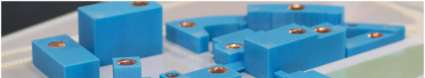
An interactive map of the Monash University Caulfield campus was built to provide students with an overview of the environment and assist with way-finding. An iterative design process was implemented, with changes to each successive model based on observation and feedback from touch readers. Some of the key findings included:
- the map was easy to understand, even by those who considered themselves unable to use tactile maps.
- students discovered important information about the campus that they had not known and were able to plan new routes of travel.
- the map provided a holistic understanding of the campus that would complement other way-finding methods.
Design considerations developed:
- the height of buildings must be low enough to ensure that fingers could comfortably reach the adjacent roads.
- roads may need to be widened and bridges raised to enable fingers to follow the travel routes.
- touch points should be designed so that the model can be fully explored by touch without triggering the audio by accident.
- audio labels should give the most important information first (e.g. name of building) followed by more detailed information so that users can listen to as much or as little as they want for each building.
- braille labels are a useful accompaniment to audio touch points.
This is an ongoing project, with plans to create further campus maps.
Last updated: August 8, 2018 at 13:49 pm